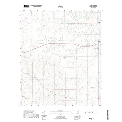
2018 Map of Bellamy
USGS Topo · Published 2018About this map
Bellamy and the uniquely named settlement of Intercourse anchor this 2018 survey of western Alabama. The landscape is defined by the winding course of the Sucarnoochee River and Alamuchee Creek in the north, giving way to a dense network of smaller drainage systems such as Cotohaga Cr, Polecat Cr, and Soctum Cr in the south. This region is characterized by small rural communities and family-named landmarks, offering clear documentation of local burial sites like Friendship Cem and Hicks Cem. The terrain rises to Soctum Hill in the southeast, while a complex grid of local roads, including Lynn Bennett Rd and Church Rd, connects these isolated points. The mapping reveals a pattern of rural land use where small-scale settlements like Lilita persist alongside significant natural water systems, providing a detailed look at Sumter County's modern topography.
Find a feature on this map
46 named features on this map. Tap any name to fly to it.
Don’t see what you’re looking for? This feature index may not catch every label — zoom into the map to look around manually.
Map Details
Editions of this 2018 Bellamy Map
This is the sole edition of this map. No revisions or reprints were ever made.
Other maps of this area

1929 · Epes
USGS Topo · 1:48,000

1932 · Epes
USGS Topo · 1:62,500

1953 · Meridian
USGS Topo · 1:250,000

1957 · Meridian
USGS Topo · 1:250,000

1965 · Meridian
USGS Topo · 1:250,000

1971 · Whitfield
USGS Topo · 1:24,000

1971 · Coatopa
USGS Topo · 1:24,000

1971 · Gaston
USGS Topo · 1:24,000

1971 · Bellamy
USGS Topo · 1:24,000

1974 · Boyd
USGS Topo · 1:24,000