2024 Map of Bellamy
USGS Topo · Published 2024About this map
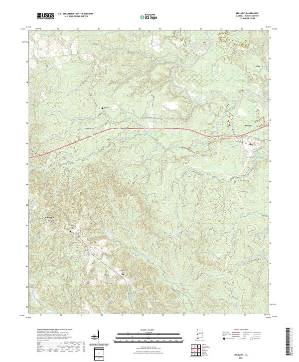
Bellamy stands as the primary settlement in this corner of Sumter County, where the southern pine forests are deeply etched by a complex drainage network flowing toward the Sucarnoochee River. The landscape is defined by its rural connectivity, with small communities like Lilita and Intercourse linked by a web of local routes including Walker Rd and Brown Rd. These roads often lead to quiet, long-standing landmarks such as Chestnut Grove Cem and Hicks Cem, which offer significant value for those tracing family history in this region of Alabama. The mapping of Cotohaga Creek, Polecat Creek, and Fourth Creek illustrates the dense hydrography that has shaped land use and local geography for generations. Near Bellamy, the street grid expands to include named ways like Pine St NE and Magnolia Cir, marking the center of local commerce and residency.
Find a feature on this map
47 named features on this map. Tap any name to fly to it.
Don’t see what you’re looking for? This feature index may not catch every label — zoom into the map to look around manually.
Map Details
Editions of this 2024 Bellamy Map
This is the sole edition of this map. No revisions or reprints were ever made.