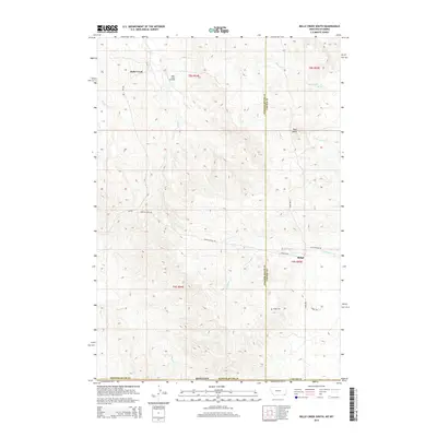
2014 Map of Belle Creek South
USGS Topo · Published 2014About this map
Belle Creek Oil Field dominates the northwest corner of this landscape, marking the intersection of the region's energy economy with its cattle-grazing tradition. The terrain is defined by the drainage networks of Belle Cr, Ranch Cr, and Thompson Cr, which carve through the high plains along the border of Powder River Co and Carter Co. This is a sparsely populated area where the infrastructure—primarily unpaved routes like Ridge-Alzada Rd and Alzada Ridge Rd—follows the high ground between creek beds.
Find a feature on this map
25 named features on this map. Tap any name to fly to it.
Don’t see what you’re looking for? This feature index may not catch every label — zoom into the map to look around manually.
Map Details
Editions of this 2014 Belle Creek South Map
This is the sole edition of this map. No revisions or reprints were ever made.
Other maps of this area

1905 · Devils Tower
USGS Topo · 1:125,000

1954 · Ekalaka
USGS Topo · 1:250,000

1954 · Gillette
USGS Topo · 1:250,000

1955 · Gillette
USGS Topo · 1:250,000

1956 · Ekalaka
USGS Topo · 1:250,000

1957 · Cedar Ridge
USGS Topo · 1:62,500

1958 · Gillette
USGS Topo · 1:250,000

1958 · Ekalaka
USGS Topo · 1:250,000

1962 · Gillette
USGS Topo · 1:250,000

1965 · Ekalaka
USGS Topo · 1:250,000