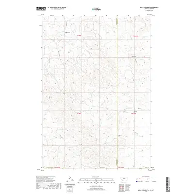
2020 Map of Belle Creek South
USGS Topo · Published 2020About this map
Ridge and Belle Creek define the human footprint on this landscape along the border of Powder River and Carter counties. The terrain is shaped by the drainage patterns of Thompson Cr and Ranch Cr, with high ground marked by the prominent West Butte. This modern survey illustrates a network of local thoroughfares such as Dinstel's Rd and Ridge Rd that navigate the varied topography of Southeast Montana. For those tracing local heritage, the Ridge Cem sits near the county line, serving as a quiet focal point for the surrounding rural ranching and oil-producing country. The map captures the remote character of this region, from the seasonal flow of Blowout Cr to the isolated 08S55E29CD__01 Spring, providing a precise look at the land's contemporary use and its enduring natural features.
Find a feature on this map
27 named features on this map. Tap any name to fly to it.
Don’t see what you’re looking for? This feature index may not catch every label — zoom into the map to look around manually.
Map Details
Editions of this 2020 Belle Creek South Map
This is the sole edition of this map. No revisions or reprints were ever made.
Other maps of this area

1905 · Devils Tower
USGS Topo · 1:125,000

1954 · Ekalaka
USGS Topo · 1:250,000

1954 · Gillette
USGS Topo · 1:250,000

1955 · Gillette
USGS Topo · 1:250,000

1956 · Ekalaka
USGS Topo · 1:250,000

1957 · Cedar Ridge
USGS Topo · 1:62,500

1958 · Gillette
USGS Topo · 1:250,000

1958 · Ekalaka
USGS Topo · 1:250,000

1962 · Gillette
USGS Topo · 1:250,000

1965 · Ekalaka
USGS Topo · 1:250,000