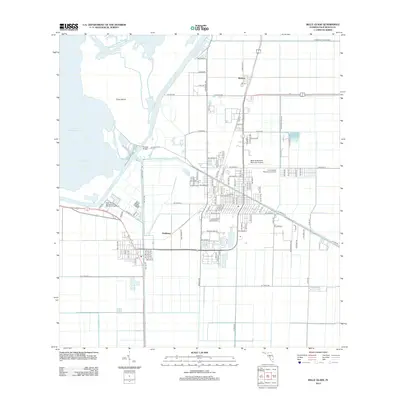
2012 Map of Belle Glade
USGS Topo · Published 2012About this map
Lake Okeechobee and its extensive canal systems define the landscape of this southern Florida agricultural hub. The water-management infrastructure is prominent, featuring the Rim Canal bordering the lake and the Hillsboro Canal cutting through the heart of the region near Chosen Bridge. This 2012 survey reveals the structured grid of the surrounding sugar country, marked by thoroughfares like W Sugar House Rd and Hooker Hwy. The map provides a detailed view of the transition from the lakeside wetlands of South Bay and Torry Island to the developed infrastructure of the Belle Glade State Municipal Airport and the Foreverglades Mausoleum Gardens. Small settlements such as Runyon and Dahlberg appear as critical points within this network of drainage and production at the edge of the Everglades.
Find a feature on this map
111 named features on this map. Tap any name to fly to it.
Don’t see what you’re looking for? This feature index may not catch every label — zoom into the map to look around manually.
Map Details
Editions of this 2012 Belle Glade Map
This is the sole edition of this map. No revisions or reprints were ever made.
Other maps of this area

1956 · West Palm Beach
USGS Topo · 1:250,000

1957 · West Palm Beach
USGS Topo · 1:250,000

1958 · West Palm Beach
USGS Topo · 1:250,000

1970 · Lake Harbor
USGS Topo · 1:24,000

1970 · Belle Glade
USGS Topo · 1:24,000

1970 · Lake Harbor SE
USGS Topo · 1:24,000

1970 · Okeelanta
USGS Topo · 1:24,000

1970 · Pahokee
USGS Topo · 1:24,000

1970 · Shawano
USGS Topo · 1:24,000

1970 · Bryant
USGS Topo · 1:24,000