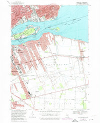
1968 Map of Belle Isle
USGS Topo · Published 1974About this map
Belle Isle Park sits prominently in the Detroit River, serving as a focal point between the urban shorelines of Detroit and Windsor during the late 1960s and early 1970s. The landscape is defined by the international border, showing the dense street grids of Grosse Pointe Park and the industrial and residential corridors of Ontario, including Walkerville and East Windsor. The map details a sophisticated network of water features on the island, such as Lake Muskoday and Blue Heron Lagoon, alongside civic infrastructure like the Filtration Plant on the Canadian shore.
Find a feature on this map
63 named features on this map. Tap any name to fly to it.
Don’t see what you’re looking for? This feature index may not catch every label — zoom into the map to look around manually.
Map Details
Editions of this 1968 Belle Isle Map
Other maps of this area

1905 · Detroit
USGS Topo · 1:62,500

1905 · Grosse Pointe
USGS Topo · 1:62,500

1906 · Wyandotte
USGS Topo · 1:62,500

1912 · Wyandotte
USGS Topo · 1:62,500

1918 · Detroit
USGS Topo · 1:62,500

1918 · Grosse Pointe
USGS Topo · 1:62,500

1924 · Detroit
USGS Topo · 1:62,500

1929 · Wyandotte
USGS Topo · 1:62,500

1934 · Detroit
USGS Topo · 1:62,500
1936 · Highland Park
USGS Topo · 1:31,680