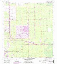
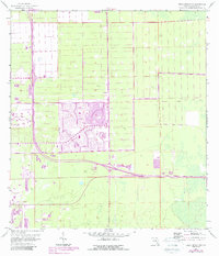
1958 Map of Belle Meade NW
USGS Topo · Published 1987About this map
Golden Gate emerges as a focal point of development in this Collier County survey, which overlays 1980s urban expansion onto a 1950s topographic base. The landscape is defined by the rigid geometry of residential planning and the critical infrastructure required to navigate the Florida wetlands. A prominent east-west artery, the Everglades Parkway—familiarly labeled Alligator Alley—cuts across the southern portion of the sheet. This Toll Road includes a marked Tollgate, illustrating the early connectivity of the region. Local amenities like a Golf Course and a Drive-in Theater reflect the mid-century social character of the area, while the presence of a Trailer Park and several Substation locations point to the growing utility and housing needs of the era.
Find a feature on this map
10 named features on this map. Tap any name to fly to it.
Don’t see what you’re looking for? This feature index may not catch every label — zoom into the map to look around manually.
Map Details
Editions of this 1958 Belle Meade NW Map
6 editions found
Other maps of this area

1956 · West Palm Beach
USGS Topo · 1:250,000

1957 · West Palm Beach
USGS Topo · 1:250,000

1958 · West Palm Beach
USGS Topo · 1:250,000

1958 · Corkscrew SE
USGS Topo · 1:24,000

1958 · Bonita Springs
USGS Topo · 1:24,000

1958 · Belle Meade
USGS Topo · 1:24,000

1958 · Naples South
USGS Topo · 1:24,000

1958 · Belle Meade NE
USGS Topo · 1:24,000

1958 · Belle Meade NW
USGS Topo · 1:24,000

1958 · Corkscrew SW
USGS Topo · 1:24,000