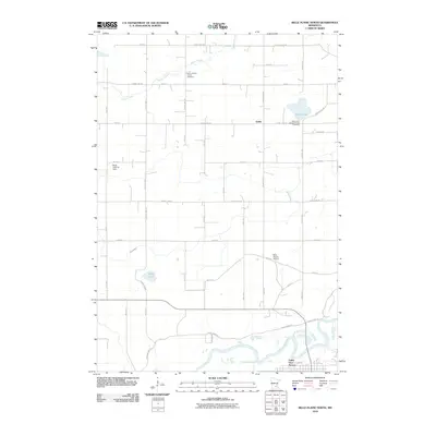
2010 Map of Belle Plaine North
USGS Topo · Published 2010About this map
The Minnesota River snakes through the southern reaches of this Scott County landscape, defining the low-lying terrain near Valley View Terrace. To the north, the topography shifts into a structured grid of agricultural tracts and rural homesteads, punctuated by small communities like Gotha. This 2010 survey reflects a period of modern rural persistence where traditional landmarks remain central to the community's geography.
Find a feature on this map
48 named features on this map. Tap any name to fly to it.
Don’t see what you’re looking for? This feature index may not catch every label — zoom into the map to look around manually.
Map Details
Editions of this 2010 Belle Plaine North Map
This is the sole edition of this map. No revisions or reprints were ever made.
Other maps of this area

1905 · Minnetonka
USGS Topo · 1:62,500

1907 · Minnetonka
USGS Topo · 1:62,500

1953 · Saint Paul
USGS Topo · 1:250,000

1957 · Belle Plaine
USGS Topo · 1:62,500

1957 · Waconia
USGS Topo · 1:62,500

1957 · New Prague
USGS Topo · 1:62,500

1958 · Victoria
USGS Topo · 1:24,000

1958 · Lake Minnetonka
USGS Topo · 1:62,500

1959 · Saint Paul
USGS Topo · 1:250,000
1981 · Norwood
USGS Topo · 1:24,000
Featured Places
- Belle Plaine, MN
- Benton Township, MN
- Valley View Terrace, Belle Plaine
- Dahlgren Township, MN
- Hancock Township, MN