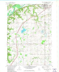
1981 Map of Belle Plaine North
USGS Topo · Published 1982About this map
The Minnesota River valley carves through this landscape, defining the northern boundary of Blakeley and Belle Plaine townships. The Chicago and North Western railroad tracks parallel the river's south bank, serving the small settlement of Blakeley and the outskirts of Belle Plaine. This corridor exhibits a distinct transition from the river bottomlands to the agricultural uplands of Tyrone and Derrynane.
Find a feature on this map
33 named features on this map. Tap any name to fly to it.
Don’t see what you’re looking for? This feature index may not catch every label — zoom into the map to look around manually.
Map Details
Editions of this 1981 Belle Plaine North Map
This is the sole edition of this map. No revisions or reprints were ever made.
Other maps of this area

1905 · Minnetonka
USGS Topo · 1:62,500

1907 · Minnetonka
USGS Topo · 1:62,500

1953 · Saint Paul
USGS Topo · 1:250,000

1957 · Belle Plaine
USGS Topo · 1:62,500

1957 · Waconia
USGS Topo · 1:62,500

1957 · New Prague
USGS Topo · 1:62,500

1958 · Victoria
USGS Topo · 1:24,000

1958 · Lake Minnetonka
USGS Topo · 1:62,500

1959 · Saint Paul
USGS Topo · 1:250,000
1981 · Norwood
USGS Topo · 1:24,000