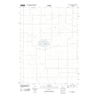
2010 Map of Belle Plaine SW
USGS Topo · Published 2010About this map
Holiday Lake serves as a central geographic feature in this section of rural Poweshiek County, defined by its intricate shoreline and the Holiday Lake Dam at its southern edge. The surrounding terrain is a network of drainage systems including North Walnut Creek, Walnut Creek, and Rock Creek, which carve through the agricultural landscape. The map reveals the persistence of early local history through the preservation of rural burial grounds, such as Squires Cemetery to the north and Kent Cemetery located just south of the lake near Kent Church Rd. The grid-like road system, with thoroughfares like 350th Ave and 310th Ave, reflects the organized land partitioning characteristic of the Iowa countryside, while Big Bear Creek skirts the southwestern corner of the quadrangle.
Find a feature on this map
24 named features on this map. Tap any name to fly to it.
Don’t see what you’re looking for? This feature index may not catch every label — zoom into the map to look around manually.
Map Details
Editions of this 2010 Belle Plaine SW Map
This is the sole edition of this map. No revisions or reprints were ever made.
Other maps of this area

1954 · Des Moines
USGS Topo · 1:250,000

1956 · Des Moines
USGS Topo · 1:250,000

1957 · Des Moines
USGS Topo · 1:250,000

1968 · Brooklyn
USGS Topo · 1:24,000

1968 · Belle Plaine SW
USGS Topo · 1:24,000

1968 · Victor
USGS Topo · 1:24,000

1968 · Belle Plaine
USGS Topo · 1:24,000

1968 · Chelsea
USGS Topo · 1:24,000

1968 · Hartwick
USGS Topo · 1:24,000

1969 · Des Moines
USGS Topo · 1:250,000