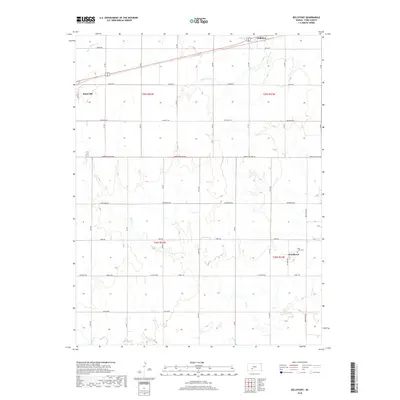
2018 Map of Bellefont
USGS Topo · Published 2018About this map
Spearville and the smaller settlements of Bellefont and Windhorst anchor this portion of Ford County, Kansas, where the high plains landscape is defined by a grid of rural roads and seasonal drainages. The local geography is etched by the courses of White Woman Cr, Little Coon Cr, and Cow Cr, which weave between expansive agricultural sections. At the southeastern edge, Windhorst is centered around Holy Cross Cem, serving as a cultural point of interest for those tracing family history in the region. The map captures a well-established road network, including thoroughfares like Eagle Rd and Iron Rd, illustrating how the township-and-range system has shaped the human footprint on the prairie. This survey offers a clear view of the rural infrastructure and land divisions that persist in modern Kansas.
Find a feature on this map
33 named features on this map. Tap any name to fly to it.
Don’t see what you’re looking for? This feature index may not catch every label — zoom into the map to look around manually.
Map Details
Editions of this 2018 Bellefont Map
This is the sole edition of this map. No revisions or reprints were ever made.
Other maps of this area

1892 · Spearville
USGS Topo · 1:125,000

1894 · Spearville
USGS Topo · 1:125,000

1955 · Pratt
USGS Topo · 1:250,000

1959 · Pratt
USGS Topo · 1:250,000

1969 · Bucklin NE
USGS Topo · 1:24,000

1969 · Bucklin NW
USGS Topo · 1:24,000

1969 · Ford
USGS Topo · 1:24,000
1972 · Bellefont
USGS Topo · 1:24,000
1972 · Offerle SE
USGS Topo · 1:24,000
1972 · Spearville
USGS Topo · 1:24,000