1972 Map of Offerle SE
USGS Topo · Published 1974About this map
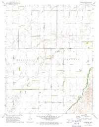
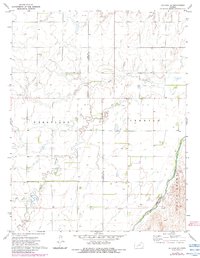
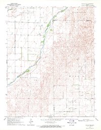
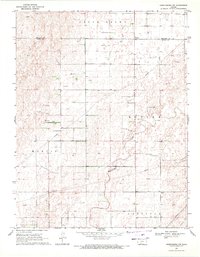
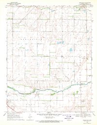
The Arkansas River cuts across the southeastern corner of this Ford County landscape, a vital water source in an area defined by large agricultural townships and historical land partitions. The Old Indian Treaty Boundary runs east-to-west through the southern portion of the map, marking a significant legal and territorial legacy that predates the modern section lines. Within the townships of Wheatland and Trenton, the land is subdivided into large tracts interspersed with several Well sites and crossing pipelines. Religious and community life is anchored by the Zion Ch, located near the winding course of Coon Creek, while Cow Creek drains the southwestern portion of the map, illustrating the area's natural drainage patterns before they reach the larger river valley.
Find a feature on this map
11 named features on this map. Tap any name to fly to it.
Don’t see what you’re looking for? This feature index may not catch every label — zoom into the map to look around manually.
Map Details
Editions of this 1972 Offerle SE Map
2 editions found
Other maps of this area

1889 · Kinsley
USGS Topo · 1:125,000

1892 · Kinsley
USGS Topo · 1:125,000

1892 · Spearville
USGS Topo · 1:125,000

1894 · Spearville
USGS Topo · 1:125,000

1894 · Kinsley
USGS Topo · 1:125,000

1955 · Pratt
USGS Topo · 1:250,000

1959 · Pratt
USGS Topo · 1:250,000
1969 · Bucklin NE
USGS Topo · 1:24,000
1969 · Greensburg NW
USGS Topo · 1:24,000
1969 · Bucklin NW
USGS Topo · 1:24,000