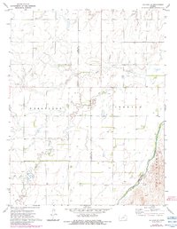
1972 Map of Offerle SE
USGS Topo · Published 1984About this map
The Old Indian Treaty Boundary slices through the southern portion of this landscape, marking a significant historical line across the Kansas plains in the early 1970s. This survey of the Ford and Edwards county line area is defined by the braided path of the Arkansas River as it sweeps through the southeastern corner, bordered by the township of South Brown. Rural life is centered around the Zion Ch and a network of agricultural townships including Wheatland and Trenton. The terrain is drained by the winding courses of Coon Creek and Cow Creek, which meander through a patchwork of section lines and scattered wells. The map documents a strictly functional landscape of mid-century grain production and land division, captured before modern center-pivot irrigation became the dominant visual feature of the region.
Find a feature on this map
10 named features on this map. Tap any name to fly to it.
Don’t see what you’re looking for? This feature index may not catch every label — zoom into the map to look around manually.
Map Details
Editions of this 1972 Offerle SE Map
2 editions found
Other maps of this area

1889 · Kinsley
USGS Topo · 1:125,000

1892 · Kinsley
USGS Topo · 1:125,000

1892 · Spearville
USGS Topo · 1:125,000

1894 · Spearville
USGS Topo · 1:125,000

1894 · Kinsley
USGS Topo · 1:125,000

1955 · Pratt
USGS Topo · 1:250,000

1959 · Pratt
USGS Topo · 1:250,000

1969 · Bucklin NE
USGS Topo · 1:24,000

1969 · Greensburg NW
USGS Topo · 1:24,000

1969 · Bucklin NW
USGS Topo · 1:24,000