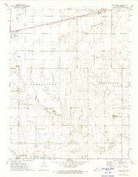
1972 Map of Bellefont
USGS Topo · Published 1974About this map
The Atchison Topeka and Santa Fe railroad corridor serves as the primary artery for this portion of Ford County, connecting the settlements of Spearville and Bellefont. The landscape is a study in prairie land management during the early 1970s, where the natural drainage of Coon Creek and Little Coon Creek is overlaid with the straight lines of section roads and energy infrastructure. An Old Indian Treaty Boundary cuts diagonally across the southern townships, a significant historical marker for those tracing early land grants and territorial divisions. To the east, the small community of Windhorst is centered around the Holy Cross Cem, while agricultural and industrial development is evidenced by the presence of an Oil Field, numerous Pipelines, and the Knoeber Landing Strip.
Find a feature on this map
19 named features on this map. Tap any name to fly to it.
Don’t see what you’re looking for? This feature index may not catch every label — zoom into the map to look around manually.
Map Details
Editions of this 1972 Bellefont Map
This is the sole edition of this map. No revisions or reprints were ever made.
Other maps of this area

1892 · Spearville
USGS Topo · 1:125,000

1894 · Spearville
USGS Topo · 1:125,000

1955 · Pratt
USGS Topo · 1:250,000

1959 · Pratt
USGS Topo · 1:250,000

1969 · Bucklin NE
USGS Topo · 1:24,000

1969 · Bucklin NW
USGS Topo · 1:24,000

1969 · Ford
USGS Topo · 1:24,000
1972 · Offerle SE
USGS Topo · 1:24,000
1972 · Spearville
USGS Topo · 1:24,000
1972 · Offerle
USGS Topo · 1:24,000