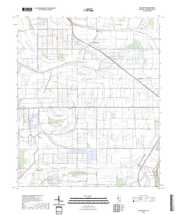
2024 Map of Bellewood
USGS Topo · Published 2024About this map
Jackson Bayou and Little Jackson Bayou wind through this alluvial landscape, defining the hydrology of the Mississippi Delta near the Yazoo River. The settlement of Bellewood serves as a primary reference point in this agricultural region, situated near the Bellewood Cem and the junction of Old US Hwy 49W. The map reveals a highly structured landscape of drainage and transport, where Tupper Bayou and Buck Bayou are flanked by numerous rural routes such as Sloppy Deadening Rd and Easy Money Rd. The southeastern corner is marked by the Belzoni Municipal Airport and the distinctively named Hard Cash Cutoff. This survey highlights the enduring reliance on bayous for natural drainage alongside modern infrastructure like Sky Lake Rd, illustrating the intersection of old waterways and 21st-century land management in Humphreys County.
Find a feature on this map
47 named features on this map. Tap any name to fly to it.
Don’t see what you’re looking for? This feature index may not catch every label — zoom into the map to look around manually.
Map Details
Editions of this 2024 Bellewood Map
This is the sole edition of this map. No revisions or reprints were ever made.
Other maps of this area

1940 · Auter
USGS Topo · 1:62,500

1940 · Baird
USGS Topo · 1:62,500

1940 · Mileston
USGS Topo · 1:62,500

1953 · Greenwood
USGS Topo · 1:250,000

1954 · Mileston
USGS Topo · 1:62,500

1956 · Greenwood
USGS Topo · 1:250,000

1961 · Mossy Lake
USGS Topo · 1:62,500
1965 · Richey
USGS Topo · 1:24,000
1965 · Midnight
USGS Topo · 1:24,000

1965 · Inverness
USGS Topo · 1:24,000