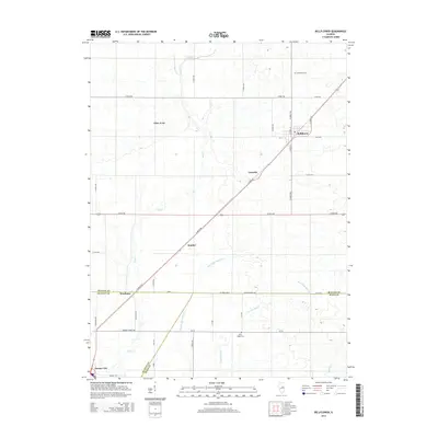
2015 Map of Bellflower
USGS Topo · Published 2015About this map
Bellflower and the surrounding agricultural landscape of McLean and DeWitt counties appear here in a network of section-line roads and prairie waterways. The village of Bellflower serves as a local hub, while smaller named points like Glen Avon, Laurette, Kumler, and Weedman define the rural crossroads of this Central Illinois region. The drainage patterns of the prairie are meticulously documented through the winding courses of Salt Cr, Blue Ridge Special Cr, and Trenkle Slough, reflecting the specialized water management systems characteristic of this productive farmland. Genealogists will find particular value in the locations of Bellflower Cem to the north and Blue Ridge Cem to the south, while the outskirts of Farmer City anchor the southwestern corner of the study area near the county lines.
Find a feature on this map
44 named features on this map. Tap any name to fly to it.
Don’t see what you’re looking for? This feature index may not catch every label — zoom into the map to look around manually.
Map Details
Editions of this 2015 Bellflower Map
This is the sole edition of this map. No revisions or reprints were ever made.
Other maps of this area

1907 · Mahomet
USGS Topo · 1:62,500

1928 · Gibson City
USGS Topo · 1:62,500

1937 · Monticello
USGS Topo · 1:48,000

1943 · Monticello
USGS Topo · 1:62,500

1952 · Arrowsmith
USGS Topo · 1:62,500

1957 · Gibson City
USGS Topo · 1:62,500

1957 · Mahomet
USGS Topo · 1:62,500

1958 · Peoria
USGS Topo · 1:250,000

1961 · Peoria
USGS Topo · 1:250,000

1963 · Peoria
USGS Topo · 1:250,000