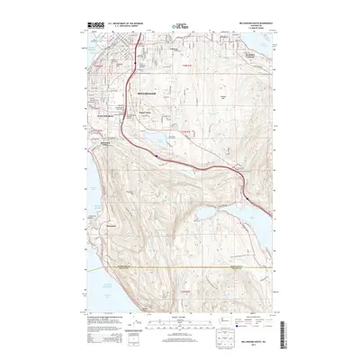
2014 Map of Bellingham South
USGS Topo · Published 2014About this map
Western Washington University serves as a central landmark for this coastal area, where the urban character of Bellingham transitions into the steep, wooded hillsides overlooking Puget Sound. The geography is defined by a series of north-south ridges and deep freshwater basins, including Lake Padden, Lake Samish, and the western edge of Lake Whatcom. These features have long dictated the development patterns of neighborhoods like Happy Valley and Sudden Valley.
Find a feature on this map
68 named features on this map. Tap any name to fly to it.
Don’t see what you’re looking for? This feature index may not catch every label — zoom into the map to look around manually.
Map Details
Editions of this 2014 Bellingham South Map
This is the sole edition of this map. No revisions or reprints were ever made.
Other maps of this area

1906 · Sumas
USGS Topo · 1:62,500

1907 · Blaine
USGS Topo · 1:62,500

1908 · Sumas
USGS Topo · 1:62,500

1918 · Samish Lake
USGS Topo · 1:62,500

1943 · Anacortes
USGS Topo · 1:62,500

1951 · Anacortes
USGS Topo · 1:62,500

1952 · Lake Whatcom
USGS Topo · 1:24,000

1952 · Lawrence
USGS Topo · 1:24,000

1952 · Alger
USGS Topo · 1:24,000

1952 · Ferndale
USGS Topo · 1:24,000