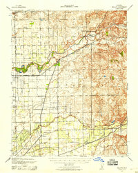
1939 Map of Bellota
USGS Topo · Published 1958About this map
Mokelumne River and the Calaveras River define the agricultural and transport landscape of this northern San Joaquin Valley region during the late 1930s. The area is characterized by a dense network of early schools, including the Oakview Union Sch and Tokay Colony Sch, indicating established rural communities centered around small settlements like Lockeford and Clements. The transport infrastructure is particularly detailed, showing the Central California Traction line running north-south through Youngston and Roma, while the Southern Pacific (Valley Spring Branch) intersects the river at Lockeford. To the southeast, the landscape transitions from the river bottoms into the foothills near Bellota, where the Stockton Terminal & Eastern rail line terminates. The map also records numerous local landmarks such as Mokelumne Beach and the historic grant boundaries of the Campo Franceses.
Find a feature on this map
42 named features on this map. Tap any name to fly to it.
Don’t see what you’re looking for? This feature index may not catch every label — zoom into the map to look around manually.
Map Details
Editions of this 1939 Bellota Map
2 editions found
Other maps of this area

1889 · Jackson
USGS Topo · 1:125,000

1892 · Jackson
USGS Topo · 1:125,000

1894 · Lodi
USGS Topo · 1:125,000

1897 · Jackson
USGS Topo · 1:125,000

1902 · Jackson
USGS Topo · 1:125,000

1908 · Waterloo
USGS Topo · 1:31,680

1908 · Linden
USGS Topo · 1:31,680

1908 · Lockeford
USGS Topo · 1:31,680

1909 · Clay
USGS Topo · 1:31,680

1909 · Goose Creek
USGS Topo · 1:31,680