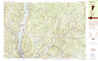
1985 Map of Bellows Falls
USGS Topo · Published 1985About this map
The Connecticut River serves as the focal point for this mid-1980s survey, marking the state boundary between Vermont and New Hampshire. On the western bank, Bellows Falls and North Walpole sit at a bend in the river, where the Boston and Maine and Central Vermont railroads intersect. The terrain rises sharply east of the river into the high ridges of Fall Mountain and Mt Kilburn.
Find a feature on this map
83 named features on this map. Tap any name to fly to it.
Don’t see what you’re looking for? This feature index may not catch every label — zoom into the map to look around manually.
Map Details
Editions of this 1985 Bellows Falls Map
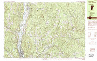
2 editions found
Other maps of this area

1902 · Sunapee
USGS Topo · 1:62,500

1905 · Sunapee
USGS Topo · 1:62,500

1907 · Sunapee
USGS Topo · 1:62,500

1926 · Claremont
USGS Topo · 1:62,500

1927 · Bellows Falls
USGS Topo · 1:48,000

1928 · Ludlow
USGS Topo · 1:48,000

1929 · Claremont
USGS Topo · 1:62,500

1929 · Ludlow
USGS Topo · 1:62,500

1930 · Saxtons River
USGS Topo · 1:48,000

1930 · Lovewell Mountain
USGS Topo · 1:62,500