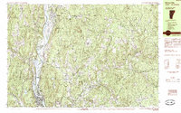
1985 Map of Bellows Falls
USGS Topo · Published 1985About this map
The Connecticut River serves as the central artery and state boundary in this mid-1980s landscape, winding past the industrial and residential clusters of Bellows Falls and North Walpole. The terrain is defined by a succession of fertile riverside meadows, including Great Meadow and Upper Meadows, which transition sharply into the steep, wooded hills of the Sullivan and Cheshire County border. The Boston and Maine railroad tracks hug the riverbank, tracing the historic transportation corridor that fueled the region's growth.
Find a feature on this map
90 named features on this map. Tap any name to fly to it.
Don’t see what you’re looking for? This feature index may not catch every label — zoom into the map to look around manually.
Map Details
Editions of this 1985 Bellows Falls Map
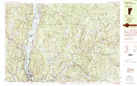
2 editions found
Other maps of this area

1902 · Sunapee
USGS Topo · 1:62,500

1905 · Sunapee
USGS Topo · 1:62,500

1907 · Sunapee
USGS Topo · 1:62,500

1926 · Claremont
USGS Topo · 1:62,500

1927 · Bellows Falls
USGS Topo · 1:48,000

1928 · Ludlow
USGS Topo · 1:48,000

1929 · Claremont
USGS Topo · 1:62,500

1929 · Ludlow
USGS Topo · 1:62,500

1930 · Saxtons River
USGS Topo · 1:48,000

1930 · Lovewell Mountain
USGS Topo · 1:62,500