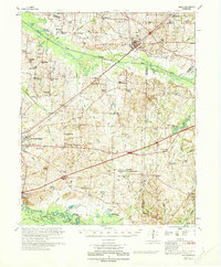
1970 Map of Bells
USGS Topo · Published 1970About this map
The South Fork Forked Deer River and Hatchie River corridors dominate this West Tennessee landscape, defining a region where river bottomlands meet upland agricultural settlements. In the southern portion, the Hatchie National Wildlife Refuge preserves the wetlands of the Hatchie Bottom, a stark contrast to the dense network of rural infrastructure found further north. This 1970 edition reveals a community organized around family-named landmarks and local institutions, with numerous country schools like Antioch Sch and Bluff Creek Sch scattered among the crossroads.
Find a feature on this map
126 named features on this map. Tap any name to fly to it.
Don’t see what you’re looking for? This feature index may not catch every label — zoom into the map to look around manually.
Map Details
Editions of this 1970 Bells Map
This is the sole edition of this map. No revisions or reprints were ever made.
Other maps of this area

1939 · Halls
USGS Topo · 1:62,500

1950 · Sunnyhill
USGS Topo · 1:24,000

1950 · Brownsville
USGS Topo · 1:24,000

1951 · Brownsville
USGS Topo · 1:24,000

1951 · Sunnyhill
USGS Topo · 1:24,000

1952 · Dancyville
USGS Topo · 1:24,000

1952 · Chestnut Bluff
USGS Topo · 1:24,000

1952 · Stanton
USGS Topo · 1:62,500

1956 · Blytheville
USGS Topo · 1:250,000

1959 · Blytheville
USGS Topo · 1:250,000