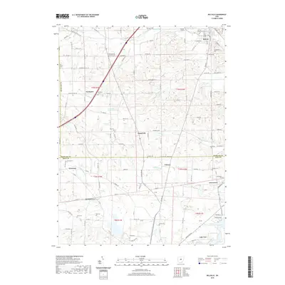
2019 Map of Bellville
USGS Topo · Published 2019About this map
Bellville serves as the primary hub in this late-2010s survey, positioned along the banks of Cedar Fork where W Durbin Ave and Market St form the village core. The map highlights a deeply agricultural landscape across the Richland and Knox county line, where small settlements like Darlington, Bangorville, and Palmyra anchor a network of township roads. Genealogists will find an exceptional concentration of burial sites, from the prominent Bellville Cem to smaller family and church grounds such as Ruhl Cem, Strong Cem, and the Pleasant Grove Evangelical Cem. The southern reach of the map is defined by the headwaters of the N Br Kokosing River and the expanding waters of Knox Lake near Lake View, illustrating the transition from the rolling hills of Schweitzer Hill to the river valleys that drain the region.
Find a feature on this map
137 named features on this map. Tap any name to fly to it.
Don’t see what you’re looking for? This feature index may not catch every label — zoom into the map to look around manually.
Map Details
Editions of this 2019 Bellville Map
This is the sole edition of this map. No revisions or reprints were ever made.
Other maps of this area

1912 · Gambier
USGS Topo · 1:62,500

1912 · Perrysville
USGS Topo · 1:62,500

1914 · Gambier
USGS Topo · 1:62,500

1915 · Perrysville
USGS Topo · 1:62,500

1915 · Shauck
USGS Topo · 1:62,500

1915 · Fredericktown
USGS Topo · 1:62,500

1943 · Shauck
USGS Topo · 1:62,500

1943 · Gambier
USGS Topo · 1:62,500

1943 · Fredericktown
USGS Topo · 1:62,500

1944 · Perrysville
USGS Topo · 1:62,500