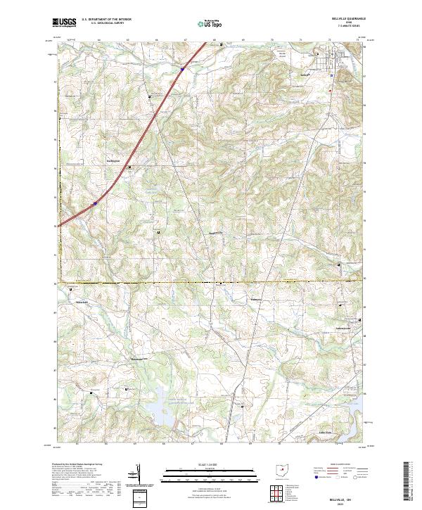
2023 Map of Bellville
USGS Topo · Published 2023About this map
Bellville serves as the primary hub in this central Ohio landscape, situated where the Clear Fork Mohican River winds through the northern reaches of the map. The settlement pattern reveals a series of small, dispersed communities including Darlington, Palmyra, and Batemantown, often anchored by family and community burial grounds such as Ruhl Cem and Quaker Cem. The terrain is defined by a dense network of tributaries, including Honey Creek and Markley Run, which flow through the agricultural fields and woodlots toward the North Branch Kokosing River Lake in the south.
Find a feature on this map
122 named features on this map. Tap any name to fly to it.
Don’t see what you’re looking for? This feature index may not catch every label — zoom into the map to look around manually.
Map Details
Editions of this 2023 Bellville Map
This is the sole edition of this map. No revisions or reprints were ever made.
Other maps of this area

1912 · Gambier
USGS Topo · 1:62,500

1912 · Perrysville
USGS Topo · 1:62,500

1914 · Gambier
USGS Topo · 1:62,500

1915 · Perrysville
USGS Topo · 1:62,500

1915 · Shauck
USGS Topo · 1:62,500

1915 · Fredericktown
USGS Topo · 1:62,500

1943 · Shauck
USGS Topo · 1:62,500

1943 · Gambier
USGS Topo · 1:62,500

1943 · Fredericktown
USGS Topo · 1:62,500

1944 · Perrysville
USGS Topo · 1:62,500