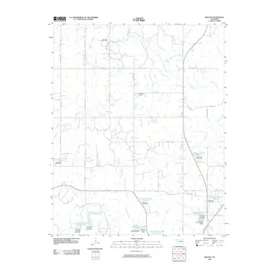
2009 Map of Bellvue
USGS Topo · Published 2009About this map
Polecat Creek and its many tributaries, including Figure Eight Creek and Mosquito Creek, dominate this rural Oklahoma landscape. The terrain is characterized by a high concentration of water management features, most notably the numerous reservoirs and dams designated for flood control on the Little Deep Fork Creek drainage. Landmarks such as Hoot Owl Hollow provide unique local identifiers within a network of section-line roads like S 449th West Ave and W 181st St S. The map reveals a transition toward engineered water basins, seen in the series of Little Deep Fork Creek Site 35 and Site 22 reservoirs, which reshaped the natural flow of Catfish Creek and Little Catfish Creek. This 2009 survey reflects the modern rural infrastructure of Creek County, where agricultural land and small drainage basins are carefully partitioned by an extensive grid of numbered avenues and streets.
Find a feature on this map
45 named features on this map. Tap any name to fly to it.
Don’t see what you’re looking for? This feature index may not catch every label — zoom into the map to look around manually.
Map Details
Editions of this 2009 Bellvue Map
This is the sole edition of this map. No revisions or reprints were ever made.
Other maps of this area

1901 · Nuyaka
USGS Topo · 1:125,000

1912 · Hominy
USGS Topo · 1:125,000

1915 · Hominy
USGS Topo · 1:125,000

1916 · Bristow
USGS Topo · 1:62,500

1929 · Yale
USGS Topo · 1:62,500

1931 · Drumright
USGS Topo · 1:62,500

1932 · Yale
USGS Topo · 1:62,500

1954 · Oklahoma City
USGS Topo · 1:250,000

1955 · Enid
USGS Topo · 1:250,000

1957 · Oklahoma City
USGS Topo · 1:250,000