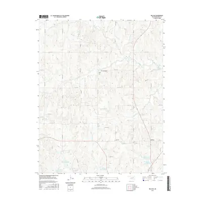
2016 Map of Bellvue
USGS Topo · Published 2016About this map
Bellvue sits at the heart of this landscape where the undulating terrain of Creek County is defined by an intricate network of waterways and small-scale reservoirs. The area exhibits a pattern of rural development focused along the section-line roads, including Oil Field Rd and Pine Hill Rd. In the northern section, Hoot Owl Hollow and the Johnson Cem offer specific points of interest for local historians, while the southern reaches are punctuated by more recent water management projects such as the Little Deep Fork Creek Site 33 Reservoir. The drainage systems of Polecat Cr and Mosquito Cr dictate the topography, creating a series of ridges and valleys that have shaped the local road network. Genealogists will find value in the documentation of the Harlinsville Cem, situated near the eastern edge of the survey area.
Find a feature on this map
50 named features on this map. Tap any name to fly to it.
Don’t see what you’re looking for? This feature index may not catch every label — zoom into the map to look around manually.
Map Details
Editions of this 2016 Bellvue Map
This is the sole edition of this map. No revisions or reprints were ever made.
Other maps of this area

1901 · Nuyaka
USGS Topo · 1:125,000

1912 · Hominy
USGS Topo · 1:125,000

1915 · Hominy
USGS Topo · 1:125,000

1916 · Bristow
USGS Topo · 1:62,500

1929 · Yale
USGS Topo · 1:62,500

1931 · Drumright
USGS Topo · 1:62,500

1932 · Yale
USGS Topo · 1:62,500

1954 · Oklahoma City
USGS Topo · 1:250,000

1955 · Enid
USGS Topo · 1:250,000

1957 · Oklahoma City
USGS Topo · 1:250,000