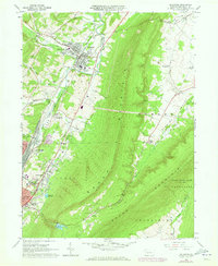
1963 Map of Bellwood
USGS Topo · Published 1973About this map
Bellwood sits at the nexus of the Juniata River and the Penn Central Tracks, serving as a central hub for the surrounding ridges. The landscape is defined by the massive spine of Brush Mountain, which separates the industrial and residential corridors of Logan and Antis from the fertile agricultural expanse of Sinking Valley. In the early 1960s, the area shows a clear progression of settlement from older village centers like Fostoria and Roots toward the growing suburban edge of Altoona East End.
Find a feature on this map
57 named features on this map. Tap any name to fly to it.
Don’t see what you’re looking for? This feature index may not catch every label — zoom into the map to look around manually.
Map Details
Editions of this 1963 Bellwood Map
4 editions found
Other maps of this area

1901 · Huntingdon
USGS Topo · 1:62,500

1902 · Hollidaysburg
USGS Topo · 1:62,500

1903 · Hollidaysburg
USGS Topo · 1:62,500

1904 · Huntingdon
USGS Topo · 1:62,500

1920 · Altoona
USGS Topo · 1:62,500

1922 · Altoona
USGS Topo · 1:62,500

1923 · Tyrone
USGS Topo · 1:62,500

1929 · Tyrone
USGS Topo · 1:48,000

1933 · Tyrone
USGS Topo · 1:62,500

1946 · Tyrone
USGS Topo · 1:62,500