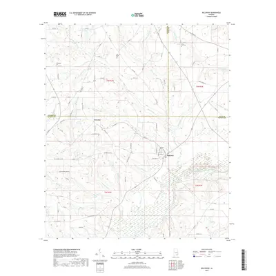
2018 Map of Bellwood
USGS Topo · Published 2018About this map
Bellwood stands at the confluence of the Choctawhatchee River and Broxson Cr, serving as a central point in this corner of Geneva County. The landscape is defined by its numerous small watercourses and family-named ponds, including Jimmy Henderson Pond and Hughes Lake. For those researching local lineages, the map identifies several rural burying grounds such as Consolation Cem, Sardis Cem, and Cool Springs Cem, which are often the primary markers of older community centers. The settlement of Scranton appears northwest of Bellwood, situated near Lake Jeanette and Lake Fox. The terrain is a network of named branches and creeks like Mauldin Cr, Berry Br, and Wilkerson Cr that feed into the larger river system. This topography reflects a late-2010s view of the Wiregrass region, where established road networks such as Kings Bay Rd and Railroad St intersect the legacy of the old rail lines that once drove the local economy.
Find a feature on this map
97 named features on this map. Tap any name to fly to it.
Don’t see what you’re looking for? This feature index may not catch every label — zoom into the map to look around manually.
Map Details
Editions of this 2018 Bellwood Map
This is the sole edition of this map. No revisions or reprints were ever made.
Other maps of this area

1942 · Enterprise
USGS Topo · 1:125,000

1948 · Ozark
USGS Topo · 1:62,500

1950 · Ozark
USGS Topo · 1:62,500

1950 · Enterprise
USGS Topo · 1:62,500

1953 · Dothan
USGS Topo · 1:250,000

1954 · Dothan
USGS Topo · 1:250,000

1955 · Dothan
USGS Topo · 1:250,000

1957 · Geneva
USGS Topo · 1:62,500

1957 · Hartford
USGS Topo · 1:62,500
1957 · Hartford
USGS Topo · 1:24,000