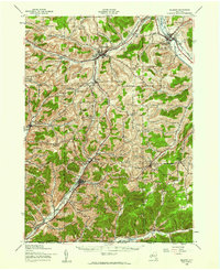
1939 Map of Belmont
USGS Topo · Published 1961About this map
Friendship and Belmont anchor this section of Allegany County during the late 1930s, a landscape defined by the winding course of the Genesee River and an extensive network of rural school districts. The map documents a transition in transportation, showing the Erie and Pittsburg Shawmut and Northern railroads alongside emerging state routes. A high density of rural schoolhouses, from Moulton Sch to the White Hill Sch, suggests a community structure still largely decentralized and tied to localized farming and industry.
Find a feature on this map
75 named features on this map. Tap any name to fly to it.
Don’t see what you’re looking for? This feature index may not catch every label — zoom into the map to look around manually.
Map Details
Editions of this 1939 Belmont Map
2 editions found

Other maps of this area

1898 · Olean
USGS Topo · 1:62,500

1906 · Angelica
USGS Topo · 1:62,500

1916 · Canaseraga
USGS Topo · 1:62,500

1924 · Franklinville
USGS Topo · 1:62,500

1925 · Belmont
USGS Topo · 1:62,500

1926 · Wellsville
USGS Topo · 1:62,500

1932 · Genesee
USGS Topo · 1:62,500

1933 · Smethport
USGS Topo · 1:62,500

1934 · Coudersport
USGS Topo · 1:48,000

1937 · Genesee
USGS Topo · 1:62,500