
1939 Map of Belmont
USGS Topo · Published 1961About this map
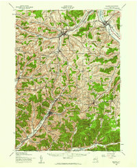
The Genesee River cuts through the northeast corner of this 1930s landscape, where the Erie RR and Pittsburg Shawmut and Northern RR once defined the region's transport network. The map reveals a dense network of rural infrastructure, particularly the numerous numbered and named school districts such as Moulton Sch and Wirt Center Sch that served the upland farming and industrial communities. In the southern reach of the quadrangle, the high point of Alma Hill 2548 towers over the surrounding valleys, marking a prominent landmark near the New York Pennsylvania state line.
Find a feature on this map
76 named features on this map. Tap any name to fly to it.
Don’t see what you’re looking for? This feature index may not catch every label — zoom into the map to look around manually.
Map Details
Editions of this 1939 Belmont Map
2 editions found
Other maps of this area

1898 · Olean
USGS Topo · 1:62,500

1906 · Angelica
USGS Topo · 1:62,500

1916 · Canaseraga
USGS Topo · 1:62,500

1924 · Franklinville
USGS Topo · 1:62,500

1925 · Belmont
USGS Topo · 1:62,500

1926 · Wellsville
USGS Topo · 1:62,500

1932 · Genesee
USGS Topo · 1:62,500

1933 · Smethport
USGS Topo · 1:62,500

1934 · Coudersport
USGS Topo · 1:48,000

1937 · Genesee
USGS Topo · 1:62,500