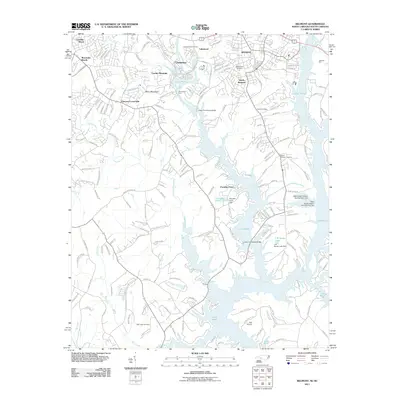
2011 Map of Belmont
USGS Topo · Published 2011About this map
Lake Wylie dominates this region along the North Carolina and South Carolina border, creating a complex shoreline that defines the local geography. The landscape transitions from the residential developments of Belmont and Cramerton down to the fingers of the lake, where infrastructure like the Upper Armstrong Bridge and Lower Armstrong Bridge connects the growing lakeside communities. Higher elevations at Cramer Mountain and Berry Mountain overlook the Catawba Creek valley, providing a clear picture of the Piedmont's varied topography.
Find a feature on this map
171 named features on this map. Tap any name to fly to it.
Don’t see what you’re looking for? This feature index may not catch every label — zoom into the map to look around manually.
Map Details
Editions of this 2011 Belmont Map
This is the sole edition of this map. No revisions or reprints were ever made.
Other maps of this area

1905 · Charlotte
USGS Topo · 1:48,000

1907 · Charlotte
USGS Topo · 1:62,500

1914 · Gastonia
USGS Topo · 1:48,000

1916 · Gastonia
USGS Topo · 1:62,500

1941 · Charlotte
USGS Topo · 1:125,000

1942 · Charlotte
USGS Topo · 1:125,000

1947 · Clover
USGS Topo · 1:62,500

1948 · Paw Creek
USGS Topo · 1:24,000

1948 · Charlotte West
USGS Topo · 1:24,000

1949 · Clover
USGS Topo · 1:62,500