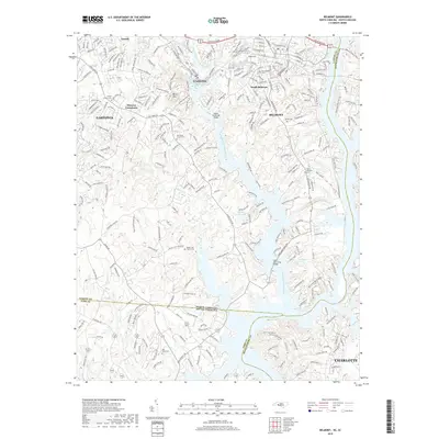
2019 Map of Belmont
USGS Topo · Published 2019About this map
The South Fork Catawba River winds through this Piedmont landscape, defining the character of Cramerton and Belmont as they interface with the expansive waters of Lake Wylie. This 2019 survey illustrates the dense suburban integration between Gastonia and Charlotte, showing how modern developments have expanded around local landmarks like Berry Mtn. Significant genealogical and local history markers are preserved across the terrain, including New Hope Church Cem and Mount Zion Church Cem. The map traces the intricate shoreline of Paradise Point Lake and the J W Stowe Lake, highlighting the bridges such as the Upper Armstrong Bridge and Lower Armstrong Bridge that connect these riverfront communities. The transition from industrial corridors to residential neighborhoods is evident near Elmores Crossroads and along the various branches of Catawba Cr.
Find a feature on this map
265 named features on this map. Tap any name to fly to it.
Don’t see what you’re looking for? This feature index may not catch every label — zoom into the map to look around manually.
Map Details
Editions of this 2019 Belmont Map
This is the sole edition of this map. No revisions or reprints were ever made.
Other maps of this area

1905 · Charlotte
USGS Topo · 1:48,000

1907 · Charlotte
USGS Topo · 1:62,500

1914 · Gastonia
USGS Topo · 1:48,000

1916 · Gastonia
USGS Topo · 1:62,500

1941 · Charlotte
USGS Topo · 1:125,000

1942 · Charlotte
USGS Topo · 1:125,000

1947 · Clover
USGS Topo · 1:62,500

1948 · Paw Creek
USGS Topo · 1:24,000

1948 · Charlotte West
USGS Topo · 1:24,000

1949 · Clover
USGS Topo · 1:62,500