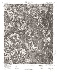
1976 Map of Belmont
USGS Topo · Published 1978About this map
South Fork River snakes through this orthophotoquad, defining the industrial and residential geography of Gaston County during the mid-1970s. This aerial perspective, captured in early 1976, provides a visual record of the established textile centers of Belmont and Cramerton as they expanded toward the shoreline. The transition from compact town centers to more dispersed suburban development is evident, particularly near Elmore Crossroads. The southern portion of the sheet is dominated by the intricate inlets and fingers of Lake Wylie, showing how the impounded river transformed the local topography into a sprawling waterfront landscape. This specific survey type replaces traditional topographic contour lines with rectified aerial imagery, allowing for the direct identification of individual structures, forest boundaries, and early lakeside subdivisions that would soon reshape the regional economy.
Find a feature on this map
5 named features on this map. Tap any name to fly to it.
Don’t see what you’re looking for? This feature index may not catch every label — zoom into the map to look around manually.
Map Details
Editions of this 1976 Belmont Map
This is the sole edition of this map. No revisions or reprints were ever made.
Other maps of this area

1905 · Charlotte
USGS Topo · 1:48,000

1907 · Charlotte
USGS Topo · 1:62,500

1914 · Gastonia
USGS Topo · 1:48,000

1916 · Gastonia
USGS Topo · 1:62,500

1941 · Charlotte
USGS Topo · 1:125,000

1942 · Charlotte
USGS Topo · 1:125,000

1947 · Clover
USGS Topo · 1:62,500

1948 · Paw Creek
USGS Topo · 1:24,000

1948 · Charlotte West
USGS Topo · 1:24,000

1949 · Clover
USGS Topo · 1:62,500