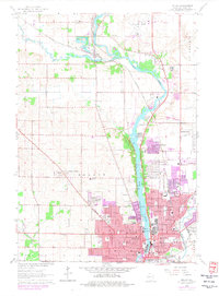
1962 Map of Beloit
USGS Topo · Published 1977About this map
The Rock River corridor defines the landscape of this 1960s survey, updated in the mid-1970s to show the expanding footprint of Beloit. The city's northern growth is evident in residential developments like Garden Village, Crestview, and Holiday Hills, which contrast with the older, established core surrounding Beloit College. To the north, the small settlement of Afton sits at a crossing of the Chicago and North Western railroad near the mouth of Bass Creek.
Find a feature on this map
71 named features on this map. Tap any name to fly to it.
Don’t see what you’re looking for? This feature index may not catch every label — zoom into the map to look around manually.
Map Details
Editions of this 1962 Beloit Map
2 editions found
Other maps of this area

1891 · Janesville
USGS Topo · 1:62,500

1893 · Janesville
USGS Topo · 1:62,500

1893 · Shopiere
USGS Topo · 1:62,500

1918 · Rockford
USGS Topo · 1:62,500

1918 · Belvidere
USGS Topo · 1:62,500

1938 · Rockford
USGS Topo · 1:62,500

1944 · Belvidere
USGS Topo · 1:62,500

1954 · Rockford
USGS Topo · 1:250,000

1955 · Rockford
USGS Topo · 1:250,000

1958 · Rockford
USGS Topo · 1:250,000