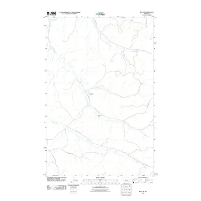
2011 Map of Belt NE
USGS Topo · Published 2011About this map
Big Willow Creek and its many tributaries, including North Willow Creek, Middle Willow Creek, and Little Belt Creek, define the drainage patterns of this central Montana landscape. The rural character of the area is underscored by the Willow Creek Ranch and infrastructure like the Willow Belt Dam. A network of local ranch roads connects the territory, with named routes like Belt Butte Cutoff Rd and Little Belt Rd providing access to the higher elevations and creek bottoms. This 2011 survey, produced by the U.S. Geological Survey, reflects the modern topography of a ranching region where the water network remains the primary structural element of the land.
Find a feature on this map
13 named features on this map. Tap any name to fly to it.
Don’t see what you’re looking for? This feature index may not catch every label — zoom into the map to look around manually.
Map Details
Editions of this 2011 Belt NE Map
This is the sole edition of this map. No revisions or reprints were ever made.
Other maps of this area

1890 · Fort Benton
USGS Topo · 1:250,000

1892 · Fort Benton
USGS Topo · 1:250,000

1897 · Fort Benton
USGS Topo · 1:250,000

1954 · Great Falls
USGS Topo · 1:250,000

1954 · Waltham
USGS Topo · 1:24,000

1956 · Highwood
USGS Topo · 1:62,500

1956 · Belt
USGS Topo · 1:62,500

1957 · Great Falls
USGS Topo · 1:250,000
1975 · Belt SE
USGS Topo · 1:24,000

1975 · Belt NW
USGS Topo · 1:24,000