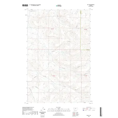
2020 Map of Belt NE
USGS Topo · Published 2020About this map
Big Willow Cr and its various branches, including N Willow Cr and Middle Willow Cr, carve a complex drainage system through the undulating terrain along the Cascade and Chouteau County line. This 2020 landscape is defined by a network of rural routes that follow the natural topography, such as Little Belt Rd and Thibedeau Rd. In the southern reaches, Little Belt Cr flows through the ranchlands near the intersection of Jarvi Rd and Johnson Marn Rd. The map illustrates a contemporary pattern of land use where section lines and high-ridge roads like E Highwood Rd overlay the deeply etched coulees and creek beds of central Montana. Historical land divisions are marked by the township and range grids, including t20n r7e and t19n r8e, providing a clear view of the area's geography just north of the Highwood Mountains.
Find a feature on this map
19 named features on this map. Tap any name to fly to it.
Don’t see what you’re looking for? This feature index may not catch every label — zoom into the map to look around manually.
Map Details
Editions of this 2020 Belt NE Map
This is the sole edition of this map. No revisions or reprints were ever made.
Other maps of this area

1890 · Fort Benton
USGS Topo · 1:250,000

1892 · Fort Benton
USGS Topo · 1:250,000

1897 · Fort Benton
USGS Topo · 1:250,000

1954 · Great Falls
USGS Topo · 1:250,000

1954 · Waltham
USGS Topo · 1:24,000

1956 · Highwood
USGS Topo · 1:62,500

1956 · Belt
USGS Topo · 1:62,500

1957 · Great Falls
USGS Topo · 1:250,000
1975 · Belt SE
USGS Topo · 1:24,000
1975 · Belt NW
USGS Topo · 1:24,000