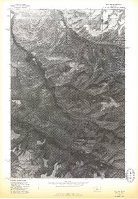
1975 Map of Belt NE
USGS Topo · Published 1975About this map
Big Willow Creek winds through the heart of this landscape in central Montana, serving as the primary drainage for the area's intricate system of coulees and ridges. This 1975 orthophotoquad provides an aerial perspective of the terrain just northeast of Belt, showing the sharp contrast between the deeply incised watercourses and the cultivated plateaus. In the northern reaches of the sheet, the headwaters of North Willow Creek emerge from the rugged breaks. The imagery captures the specific agricultural patterns of the mid-1970s, where rectilinear fields are etched into the higher ground above the sinuous, brush-lined creek beds. This visual record is particularly valuable for documenting ranching boundaries and land-use practices before later 20th-century developments altered the rural character of the Big Belt Mountains foothills.
Find a feature on this map
2 named features on this map. Tap any name to fly to it.
Don’t see what you’re looking for? This feature index may not catch every label — zoom into the map to look around manually.
Map Details
Editions of this 1975 Belt NE Map
This is the sole edition of this map. No revisions or reprints were ever made.
Other maps of this area

1890 · Fort Benton
USGS Topo · 1:250,000

1892 · Fort Benton
USGS Topo · 1:250,000

1897 · Fort Benton
USGS Topo · 1:250,000

1954 · Great Falls
USGS Topo · 1:250,000

1954 · Waltham
USGS Topo · 1:24,000

1956 · Highwood
USGS Topo · 1:62,500

1956 · Belt
USGS Topo · 1:62,500

1957 · Great Falls
USGS Topo · 1:250,000
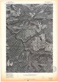
1975 · Belt SE
USGS Topo · 1:24,000

1975 · Belt NW
USGS Topo · 1:24,000