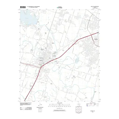
2010 Map of Belton
USGS Topo · Published 2010About this map
Belton and the western edge of Temple anchor this central Texas landscape where the Leon River and Lampasas River converge. The town's historical foundations are visible through the Baylor Female College Historic District and the Belton Commercial Historic District, alongside industrial landmarks like the Belton Yarn Mill and the Belton Standpipe. To the north, the massive Belton Dam contains Belton Lake, significantly altering the hydrology of the river valley. The region is marked by its numerous burial grounds, including the North Belton Cemetery, South Belton Cemetery, and East Belton Cemetery, providing a dense record for genealogical research. Transportation and infrastructure are central to the layout, featuring the Missouri, Kansas and Texas Railroad Bridge and the State Highway 53 Bridge crossing near the Temple City Lake Dam. Smaller communities like Midway, Hobbs, and Taylors Valley appear as suburban nodes connected by a developing road network including S General Bruce DR and University DR.
Find a feature on this map
88 named features on this map. Tap any name to fly to it.
Don’t see what you’re looking for? This feature index may not catch every label — zoom into the map to look around manually.
Map Details
Editions of this 2010 Belton Map
This is the sole edition of this map. No revisions or reprints were ever made.
Other maps of this area

1885 · Taylor
USGS Topo · 1:125,000

1887 · Taylor
USGS Topo · 1:125,000

1892 · Temple
USGS Topo · 1:125,000

1893 · Georgetown
USGS Topo · 1:125,000

1894 · Gatesville
USGS Topo · 1:125,000

1894 · Taylor
USGS Topo · 1:125,000

1924 · Gatesville 4-d
USGS Topo · 1:48,000

1924 · Gatesville 4-a
USGS Topo · 1:48,000

1924 · Temple 3-C
USGS Topo · 1:48,000

1924 · Temple 3-B
USGS Topo · 1:48,000