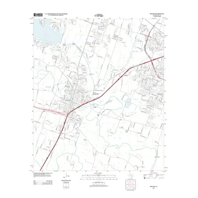
2012 Map of Belton
USGS Topo · Published 2012About this map
Belton Commercial Historic District and the Baylor Female College Historic District anchor this central Texas landscape, where the confluence of the Leon River and Nolan Cr shaped early settlement patterns. This 2012 study details the industrial and institutional legacy of the region, specifically marking the Belton Yarn Mill and the historic Belton Standpipe. To the east and south, the terrain transitions into the agricultural reaches of Taylors Valley and the bluff-lined banks of the Lampasas River. Notable for genealogists, the map identifies a high concentration of burial grounds, including the N Belton Cem, S Belton Cem, and Allen Cem. Infrastructure such as the Missouri, Kansas and Texas Railroad Bridge and S General Bruce Dr illustrate the transportation corridors that replaced older river-based economies, while landmarks like Childers Springs and Hartrick Bluff persist as fixed points in the changing geography.
Find a feature on this map
44 named features on this map. Tap any name to fly to it.
Don’t see what you’re looking for? This feature index may not catch every label — zoom into the map to look around manually.
Map Details
Editions of this 2012 Belton Map
This is the sole edition of this map. No revisions or reprints were ever made.
Other maps of this area

1885 · Taylor
USGS Topo · 1:125,000

1887 · Taylor
USGS Topo · 1:125,000

1892 · Temple
USGS Topo · 1:125,000

1893 · Georgetown
USGS Topo · 1:125,000

1894 · Gatesville
USGS Topo · 1:125,000

1894 · Taylor
USGS Topo · 1:125,000

1924 · Gatesville 4-d
USGS Topo · 1:48,000

1924 · Gatesville 4-a
USGS Topo · 1:48,000

1924 · Temple 3-C
USGS Topo · 1:48,000

1924 · Temple 3-B
USGS Topo · 1:48,000