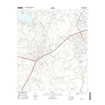
2016 Map of Belton
USGS Topo · Published 2016About this map
The Belton and Temple corridor is defined by the convergence of the Leon River and the Lampasas River, where mid-20th century infrastructure meets older Texas settlements. Centered on the Univ of Mary Hardin-Baylor campus, this area showcases the expansion of regional transportation, notably the Missouri, Kansas and Texas Railroad Bridge and the State Highway 53 Bridge. The landscape is dotted with numerous small burial grounds that speak to the area's genealogical depth, including North Belton Cem, South Belton Cem, and more isolated sites like Ferguson Cem near Hartrick Bluff. Water management and recreation are prominent through the presence of Belton Lake and the Northgate Reservoir, while smaller communities such as Midway, Hobbs, and Taylors Valley maintain their distinct identities between the larger urban centers.
Find a feature on this map
32 named features on this map. Tap any name to fly to it.
Don’t see what you’re looking for? This feature index may not catch every label — zoom into the map to look around manually.
Map Details
Editions of this 2016 Belton Map
This is the sole edition of this map. No revisions or reprints were ever made.
Other maps of this area

1885 · Taylor
USGS Topo · 1:125,000

1887 · Taylor
USGS Topo · 1:125,000

1892 · Temple
USGS Topo · 1:125,000

1893 · Georgetown
USGS Topo · 1:125,000

1894 · Gatesville
USGS Topo · 1:125,000

1894 · Taylor
USGS Topo · 1:125,000

1924 · Gatesville 4-d
USGS Topo · 1:48,000

1924 · Gatesville 4-a
USGS Topo · 1:48,000

1924 · Temple 3-C
USGS Topo · 1:48,000

1924 · Temple 3-B
USGS Topo · 1:48,000