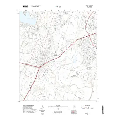
2019 Map of Belton
USGS Topo · Published 2019About this map
Nolan Creek and the Leon River converge near the growing suburban landscape of central Texas, where the historic communities of Belton and Temple meet. This 2019 survey documents a region characterized by significant river systems and transportation corridors, including the Missouri, Kansas and Texas Railroad Bridge crossing over the Leon. The map reveals a dense concentration of local heritage sites, particularly cemeteries such as North Belton Cem, South Belton Cem, and the more rural Ferguson Cem further east. The topography is marked by the steep rise of Hartrick Bluff and the waters of Belton Lake in the northwest, illustrating the transition from the manicured parks and residential developments like Childers Springs to the more open terrain near Taylors Valley.
Find a feature on this map
277 named features on this map. Tap any name to fly to it.
Don’t see what you’re looking for? This feature index may not catch every label — zoom into the map to look around manually.
Map Details
Editions of this 2019 Belton Map
This is the sole edition of this map. No revisions or reprints were ever made.
Other maps of this area

1885 · Taylor
USGS Topo · 1:125,000

1887 · Taylor
USGS Topo · 1:125,000

1892 · Temple
USGS Topo · 1:125,000

1893 · Georgetown
USGS Topo · 1:125,000

1894 · Gatesville
USGS Topo · 1:125,000

1894 · Taylor
USGS Topo · 1:125,000

1924 · Gatesville 4-d
USGS Topo · 1:48,000

1924 · Gatesville 4-a
USGS Topo · 1:48,000

1924 · Temple 3-C
USGS Topo · 1:48,000

1924 · Temple 3-B
USGS Topo · 1:48,000