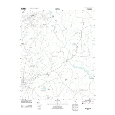
2011 Map of Belton East
USGS Topo · Published 2011About this map
The Saluda River winds through this Piedmont landscape between Williamston and Belton, illustrating the region's agricultural and industrial heritage. The map details a network of water management features, including several unnamed dams and the Pelzer Mills Dam, alongside established crossings like Hollands Ford and Pierces Ford. The area around Toney Creek and Cheddar remains characterized by large-scale land use, highlighted by Callaham Orchards and Moores Field. For genealogists, the map is particularly helpful for locating local burial sites, such as the Big Creek Baptist Cemetery, Beech Springs Cemetery, and Cedar Shoals Cemetery. The urban centers at the map's corners are anchored by the Belton Post Office and the residential expansion near the Williamston Cemetery, showing the transition from rural river bottoms to established town centers.
Find a feature on this map
154 named features on this map. Tap any name to fly to it.
Don’t see what you’re looking for? This feature index may not catch every label — zoom into the map to look around manually.
Map Details
Editions of this 2011 Belton East Map
This is the sole edition of this map. No revisions or reprints were ever made.
Other maps of this area

1888 · Pickens
USGS Topo · 1:125,000

1892 · Abbeville
USGS Topo · 1:125,000

1893 · Elberton
USGS Topo · 1:125,000

1894 · Pickens
USGS Topo · 1:125,000

1954 · Greenville
USGS Topo · 1:250,000

1957 · Anderson
USGS Topo · 1:62,500

1957 · Williamston
USGS Topo · 1:62,500

1958 · Greenville
USGS Topo · 1:250,000

1964 · Saylors Crossroads
USGS Topo · 1:24,000
1970 · Honea Path
USGS Topo · 1:24,000