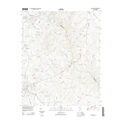
2014 Map of Belton East
USGS Topo · Published 2014About this map
Williamston and Belton anchor this segment of the Piedmont, where the landscape is defined by the winding course of the Saluda River. The river forms a natural boundary between Anderson and Greenville counties, crossed at traditional points such as Hollands Ford and Pierces Ford. The area shows a transition from structured town grids to a rural network of roads like Cooley Bridge Rd and Augusta Rd. Numerous community anchors are visible, including the Big Creek Baptist Cem and Shady Grove Cem, which serve as vital markers for local genealogy.
Find a feature on this map
181 named features on this map. Tap any name to fly to it.
Don’t see what you’re looking for? This feature index may not catch every label — zoom into the map to look around manually.
Map Details
Editions of this 2014 Belton East Map
This is the sole edition of this map. No revisions or reprints were ever made.
Other maps of this area

1888 · Pickens
USGS Topo · 1:125,000

1892 · Abbeville
USGS Topo · 1:125,000

1893 · Elberton
USGS Topo · 1:125,000

1894 · Pickens
USGS Topo · 1:125,000

1954 · Greenville
USGS Topo · 1:250,000

1957 · Anderson
USGS Topo · 1:62,500

1957 · Williamston
USGS Topo · 1:62,500

1958 · Greenville
USGS Topo · 1:250,000

1964 · Saylors Crossroads
USGS Topo · 1:24,000
1970 · Honea Path
USGS Topo · 1:24,000