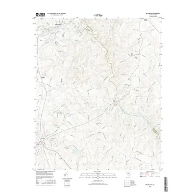
2017 Map of Belton East
USGS Topo · Published 2017About this map
The Saluda River winds along the border of Anderson and Greenville Counties, serving as the central geographic feature of this Piedmont landscape. The river valley is punctuated by several small communities and significant rural intersections, including Cheddar, Toney Creek, and Cooley Bridge. To the northwest, the town of Williamston shows a developed street grid, while the city of Belton anchors the southwestern corner. These settlements are connected by a dense network of secondary roads that reflect the area's agricultural and textile-based development.
Find a feature on this map
151 named features on this map. Tap any name to fly to it.
Don’t see what you’re looking for? This feature index may not catch every label — zoom into the map to look around manually.
Map Details
Editions of this 2017 Belton East Map
This is the sole edition of this map. No revisions or reprints were ever made.
Other maps of this area

1888 · Pickens
USGS Topo · 1:125,000

1892 · Abbeville
USGS Topo · 1:125,000

1893 · Elberton
USGS Topo · 1:125,000

1894 · Pickens
USGS Topo · 1:125,000

1954 · Greenville
USGS Topo · 1:250,000

1957 · Anderson
USGS Topo · 1:62,500

1957 · Williamston
USGS Topo · 1:62,500

1958 · Greenville
USGS Topo · 1:250,000

1964 · Saylors Crossroads
USGS Topo · 1:24,000
1970 · Honea Path
USGS Topo · 1:24,000