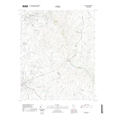
2020 Map of Belton East
USGS Topo · Published 2020About this map
The Saluda River carves a winding path through the heart of the Upstate, serving as the natural boundary between Anderson and Greenville counties. This 2020 landscape is defined by the historic hubs of Williamston and Belton, connected by a network of rural roads such as Cooley Bridge Rd and Cannon Bottom Rd. The area maintains its agricultural and spiritual character, evidenced by numerous long-standing religious sites including the Cedar Shoals Baptist Church Graveyard and Shady Grove Baptist Church Graveyard. Smaller communities like Cheddar and Toney Creek remain anchored to the land, while the presence of the City of Belton Cem and Williamston Cem offers significant points of interest for those researching local family lineages and the settlement patterns of the Piedmont.
Find a feature on this map
160 named features on this map. Tap any name to fly to it.
Don’t see what you’re looking for? This feature index may not catch every label — zoom into the map to look around manually.
Map Details
Editions of this 2020 Belton East Map
This is the sole edition of this map. No revisions or reprints were ever made.
Other maps of this area

1888 · Pickens
USGS Topo · 1:125,000

1892 · Abbeville
USGS Topo · 1:125,000

1893 · Elberton
USGS Topo · 1:125,000

1894 · Pickens
USGS Topo · 1:125,000

1954 · Greenville
USGS Topo · 1:250,000

1957 · Anderson
USGS Topo · 1:62,500

1957 · Williamston
USGS Topo · 1:62,500

1958 · Greenville
USGS Topo · 1:250,000

1964 · Saylors Crossroads
USGS Topo · 1:24,000
1970 · Honea Path
USGS Topo · 1:24,000