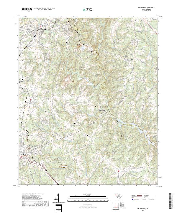
2024 Map of Belton East
USGS Topo · Published 2024About this map
Williamston and Belton anchor the western edge of this region, where the terrain is defined by the winding course of the Saluda River and its numerous tributaries. The landscape is dotted with several significant burial sites and rural congregations, including the Cedar Grove Baptist Church Graveyard and Shady Grove Baptist Church Graveyard, reflecting a deeply rooted community history. The river creates a natural boundary, featuring the Saluda Bend and the crossing at Clarks Ferry. Away from the river, the area is partitioned by the Greenville Co and Anderson Co line. Smaller settlements like Cheddar, Toney Creek, and Ware Place are connected by a network of local roads such as Blake Dairy Rd and Rocky Ford Rd. Water features like August Pond and Broadmouth Cr-Watershed Two Lake indicate the managed water systems throughout this part of South Carolina.
Find a feature on this map
163 named features on this map. Tap any name to fly to it.
Don’t see what you’re looking for? This feature index may not catch every label — zoom into the map to look around manually.
Map Details
Editions of this 2024 Belton East Map
This is the sole edition of this map. No revisions or reprints were ever made.
Other maps of this area

1888 · Pickens
USGS Topo · 1:125,000

1892 · Abbeville
USGS Topo · 1:125,000

1893 · Elberton
USGS Topo · 1:125,000

1894 · Pickens
USGS Topo · 1:125,000

1954 · Greenville
USGS Topo · 1:250,000

1957 · Anderson
USGS Topo · 1:62,500

1957 · Williamston
USGS Topo · 1:62,500

1958 · Greenville
USGS Topo · 1:250,000

1964 · Saylors Crossroads
USGS Topo · 1:24,000
1970 · Honea Path
USGS Topo · 1:24,000