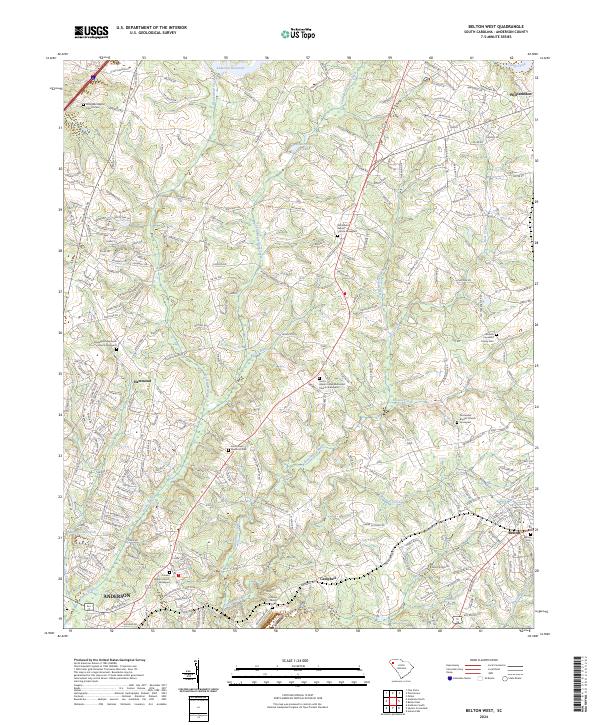
2024 Map of Belton West
USGS Topo · Published 2024About this map
Rocky River and its numerous tributaries, including Broadway Creek and Beaverdam Creek, carve through this section of Anderson County, defining a landscape traditionally rooted in rural church communities. The map reveals a dense network of spiritual and genealogical centers, from the Midway Presbyterian Church Graveyard in the west to the Union Grove United Methodist Church Graveyard near the center. These sites, along with smaller family plots like the Nichols Copeland Family Cem, offer a detailed record of local lineage across generations.
Find a feature on this map
240 named features on this map. Tap any name to fly to it.
Don’t see what you’re looking for? This feature index may not catch every label — zoom into the map to look around manually.
Map Details
Editions of this 2024 Belton West Map
This is the sole edition of this map. No revisions or reprints were ever made.
Other maps of this area

1888 · Pickens
USGS Topo · 1:125,000

1892 · Abbeville
USGS Topo · 1:125,000

1893 · Elberton
USGS Topo · 1:125,000

1894 · Pickens
USGS Topo · 1:125,000

1954 · Greenville
USGS Topo · 1:250,000

1957 · Anderson
USGS Topo · 1:62,500

1957 · Williamston
USGS Topo · 1:62,500

1958 · Greenville
USGS Topo · 1:250,000

1964 · Saylors Crossroads
USGS Topo · 1:24,000
1964 · Anderson South
USGS Topo · 1:24,000