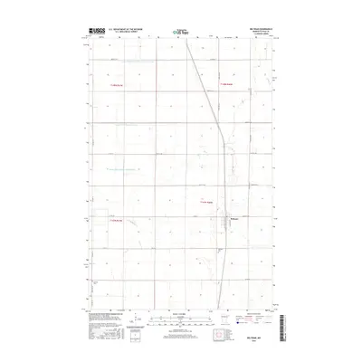
2016 Map of Beltrami
USGS Topo · Published 2016About this map
Beltrami sits at the heart of this Polk County landscape, defined by a highly structured drainage network essential for agriculture in the Red River Valley. The map documents an intricate system of waterways, including County Ditch Number One Hundred Nineteen, County Ditch Number Fortysix, and County Ditch Number Seventythree, which channel water across the flat terrain toward the Sand Hill River and Maple Cr. This 2016 survey illustrates the grid-based development of the region, where a dense network of township roads like 230th Ave SW and 400th St SW serves local farmsteads. For those researching local heritage, the map identifies significant sites such as Fairview Cem just south of the town center and Scandia Cem located further west, marking the locations of early community gathering points and family histories.
Find a feature on this map
30 named features on this map. Tap any name to fly to it.
Don’t see what you’re looking for? This feature index may not catch every label — zoom into the map to look around manually.
Map Details
Editions of this 2016 Beltrami Map
This is the sole edition of this map. No revisions or reprints were ever made.
Other maps of this area

1918 · Twin Valley
USGS Topo · 1:62,500

1919 · Beltrami
USGS Topo · 1:62,500

1924 · Ada
USGS Topo · 1:62,500

1952 · Grand Forks
USGS Topo · 1:250,000

1956 · Grand Forks
USGS Topo · 1:250,000

1964 · Beltrami
USGS Topo · 1:24,000

1964 · Beltrami SW
USGS Topo · 1:24,000

1964 · Girard
USGS Topo · 1:24,000

1964 · Greenview
USGS Topo · 1:24,000

1965 · Lockhart
USGS Topo · 1:24,000