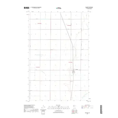
2019 Map of Beltrami
USGS Topo · Published 2019About this map
Beltrami sits at the heart of this Polk County landscape, oriented around the intersection of Atlantic Ave and 430th St SW. The town's grid includes a Po and is surrounded by a sprawling network of water management features that define the region's agricultural character. This highly engineered drainage system is marked by the County Ditch Number Seventythree, County Ditch Number Forty six, and Judicial Ditch Number Fiftythree, which channel water toward the Sand Hill River. To the north, Maple Cr meanders across the plain. The survey also captures local heritage sites, including Fairview Cem south of the main settlement and Scandia Cem located further west along Co Hwy 14. These landmarks, along with the section-line roads, reflect the rigid, functional layout typical of the Red River Valley’s farming heartland.
Find a feature on this map
33 named features on this map. Tap any name to fly to it.
Don’t see what you’re looking for? This feature index may not catch every label — zoom into the map to look around manually.
Map Details
Editions of this 2019 Beltrami Map
This is the sole edition of this map. No revisions or reprints were ever made.
Other maps of this area

1918 · Twin Valley
USGS Topo · 1:62,500

1919 · Beltrami
USGS Topo · 1:62,500

1924 · Ada
USGS Topo · 1:62,500

1952 · Grand Forks
USGS Topo · 1:250,000

1956 · Grand Forks
USGS Topo · 1:250,000

1964 · Beltrami
USGS Topo · 1:24,000

1964 · Beltrami SW
USGS Topo · 1:24,000

1964 · Girard
USGS Topo · 1:24,000

1964 · Greenview
USGS Topo · 1:24,000

1965 · Lockhart
USGS Topo · 1:24,000