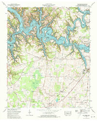
1972 Map of Belvidere
USGS Topo · Published 1973About this map
The Elk River valley is dominated by the sprawling waters of Tims Ford Lake, reflecting a landscape transformed by the Tennessee Valley Authority. This 1972 revision shows the newly flooded contours of the reservoir, where once-dry land features like Maple Bend and Fanning Bend now define the shoreline. The southern portion of the map remains largely agricultural, centered around the settlement of Belvidere and the Louisville and Nashville railroad line.
Find a feature on this map
67 named features on this map. Tap any name to fly to it.
Don’t see what you’re looking for? This feature index may not catch every label — zoom into the map to look around manually.
Map Details
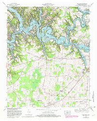
Editions of this 1972 Belvidere Map
2 editions found
Other maps of this area

1928 · Decherd
USGS Topo · 1:62,500

1936 · Cumberland Springs
USGS Topo · 1:24,000

1936 · Beans Creek
USGS Topo · 1:24,000

1936 · Winchester
USGS Topo · 1:24,000

1936 · Huntland
USGS Topo · 1:24,000

1936 · Belvidere
USGS Topo · 1:24,000

1936 · Pitcher Ridge
USGS Topo · 1:24,000

1936 · Camp Peay
USGS Topo · 1:24,000

1936 · Capitol Hill
USGS Topo · 1:24,000

1936 · Lois
USGS Topo · 1:24,000