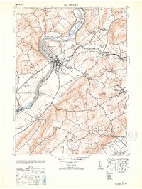
1953 Map of Belvidere
USGS Topo · Published 1953About this map
The Delaware River carves a sharp path through Warren County on this mid-century survey, defining the border between New Jersey and Pennsylvania at Foul Rift. The county seat of Belvidere sits at the confluence with the Pequest River, serving as a central hub for industrial activity including the Hercules Powder Co and the Pequest Hosiery Mill. Transportation networks dominate the landscape, with the Belvidere Division and Delaware railroads following the river's edge, and historical crossing points like Hartzells Ferry still noted.
Find a feature on this map
54 named features on this map. Tap any name to fly to it.
Don’t see what you’re looking for? This feature index may not catch every label — zoom into the map to look around manually.
Map Details
Editions of this 1953 Belvidere Map
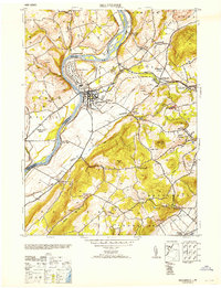
2 editions found
Other maps of this area

1888 · Hackettstown
USGS Topo · 1:62,500

1890 · Easton
USGS Topo · 1:62,500

1890 · High Bridge
USGS Topo · 1:62,500

1891 · Easton
USGS Topo · 1:62,500

1891 · Delaware Water Gap
USGS Topo · 1:62,500

1893 · Delaware Water Gap
USGS Topo · 1:62,500

1894 · Hackettstown
USGS Topo · 1:62,500

1898 · Hackettstown
USGS Topo · 1:62,500

1898 · High Bridge
USGS Topo · 1:62,500

1900 · Raritan
USGS Topo · 1:125,000